Urban Semantic Graphs
Enhancing city knowledge through ontologies and linked data
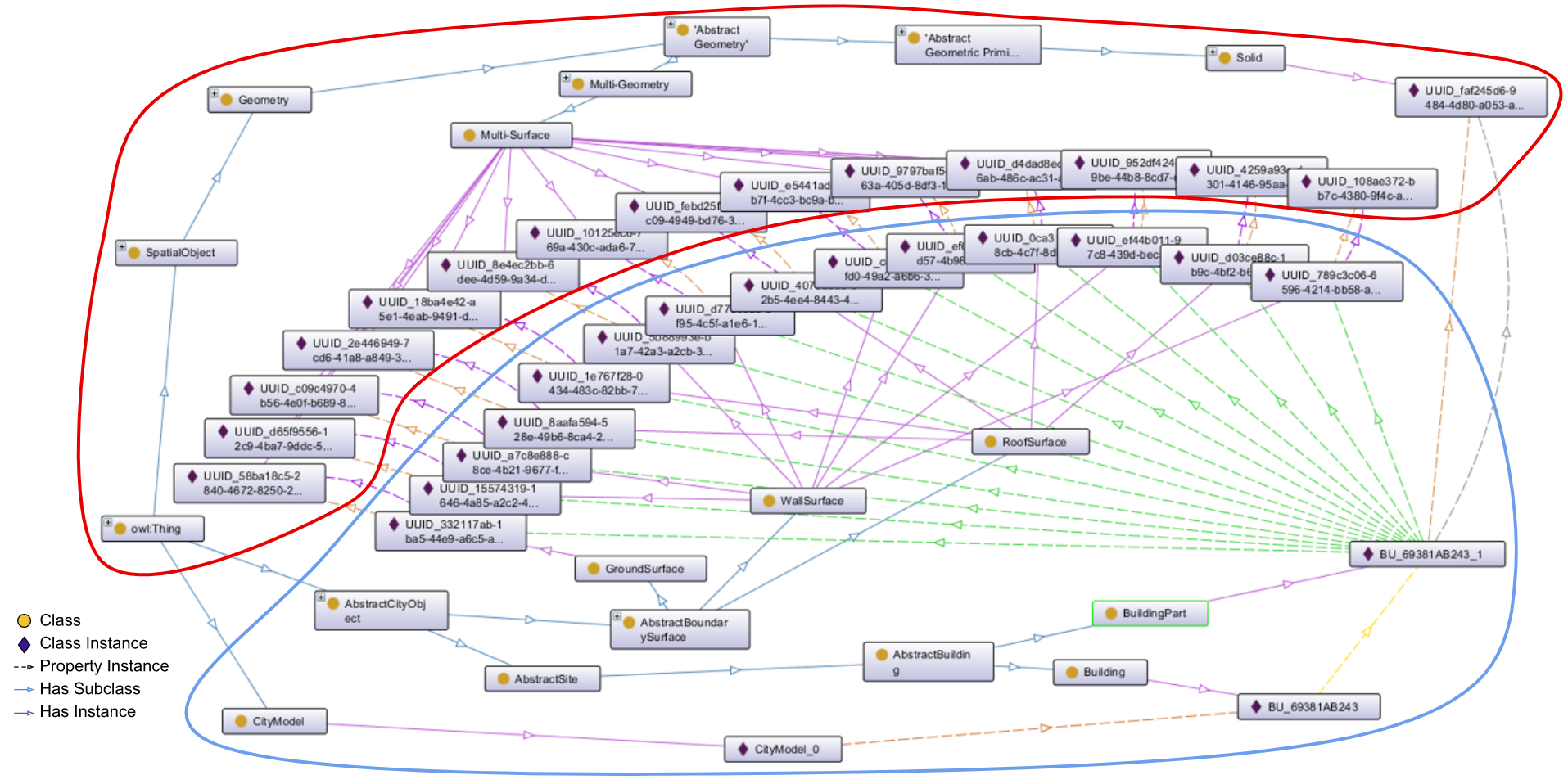
We explore how to convert geospatial urban data formats into linked data representations and exploit these generated data to understand the urban landscape. Recent works have demonstrated the use of ontologies and linked-data formats to extend existing nD GIS modeling formats, such as CityGML, facilitate data transformations, and add valuable interoperability aspects.
We are currently developing tools that generate ontological information models based on these urban data models through transformation mappings and conversion techniques. Additionally, these tools also explore the transformation of nD urban data instances into graph formats (such as Resource Description Framework) and how these datasets can be stored, queried, and visualized. Using existing geospatial linked data and semantic web technologies, such as OWL reasoners or the Open Geospatial Consortium’s (OGC) GeoSPARQL standards, we can enrich and ensure interoperability of open data city models. Furthermore, we can infer unintuitive relationships between data instances and models and open the door for integrating other modeling standards (such as IFC/BIM).