Managing Documents in a 3D city scene
Many databases describe the city and its elements from different points of view, dates, and objectives (construction allowed for a building, reflection of urban planners on the development of a given city area, architectural plans, and others). However, browsing such data requires the utilization of universal identifiers to link each component to its equivalent in another database. Such identifiers remain rare and inaccessible unless all these data link to the same element: the object of the city which they describe.
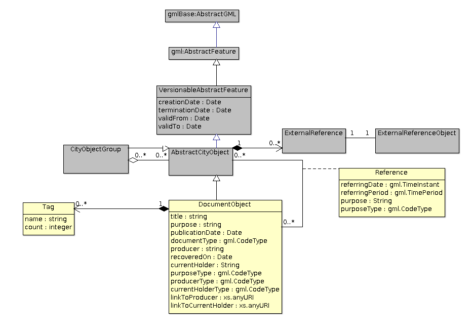
Thanks to the improvement in generating techniques for 3D models of the city, these are becoming more comprehensive, realistic, and accessible. We, therefore, believe that such models can also store the sets of documents by linking them to the urban objects represented in 3D. An identifier would thus no longer be the only way to select an element of the city and the different related information related. The user could move into the city, click on the urban item that interests them, and directly get the list of available documents.
The Alaric project implements this possibility by grouping and analyzing several documentary corpora describing two centuries of urban transformation in the cities of Terrenoire and Givors. These documents are then bound to a mapping whose objective is to offer a 3D visualization of the evolution of these two areas over time; through the access to the documents that allowed the interpretation and creation of this 3D city model.
Online demonstrations
- Attaching multimedia documents to city scenes