Create temporal 3D model of flooding
In order to support raising public awareness of flood risk along the Rhône river, it should be necessary to propose digital 3D temporal georeferenced models that can be largely diffused among riverside residents. We have proposed a method to generate such a model by combining multiple datasets: the Digital Elevation Model of the terrain, grid of water heights during a flood, building footprints, and 3D models of noticeable buildings. We use all these models to generate temporal CityGML modeling in 3D for the entire flood process over time.
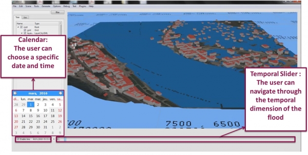
The city model created is stored in temporal CityGML files that can be opened in 3D-Use to visualize the temporal evolution of a flood simulation on the Rhône river.
Videos
More information concerning this project
Publications
This work has been presented at the international Workshop “Urban Data Modelling and Visualisation 2016”.